Environmental Visualization (EVIS)
|

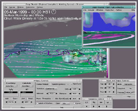
EVIS researchers are applying the knowledge gained from the MHSII project by developing workflow tools that collect, stage, error check, and visualize METOC information. This information will be turned into knowledge available to key decision makers and warfare commanders.
|
|
|
 |
|
|
EVIS in Action
|
|
For Examples of Environmental Visualization used in Weather Forecasting, click here ( >>> )
|
|
Project Lead and POC
|
|
Jim Ballas, Naval Research Laboratory, Washington DC
|
|
Other Participants
|
|
Naval Research Laboratory, Monterey, CA
Applied Physics Laboratory, University of Washington
Space and Naval Warfare Systems Command Center (SPAWARSYSCOM)
Naval Undersea Warfare Center, Newport, RI
|
|
Sponsor
|
|
Knowledge Superiority Assurance (KSA), Future Naval Capability (FNC), Office of Naval Research
|